
Antlers Bridge · I-5 — about 0.8 mi from the campground
Camera operated by Caltrans District 2

Frame refreshes about every 5 min · feed last verified
Useful for road surface, smoke and haze — not for checking your site.
Sacramento Arm · Shasta Lake Corridor · 40.88797, -122.36815
$160 / night
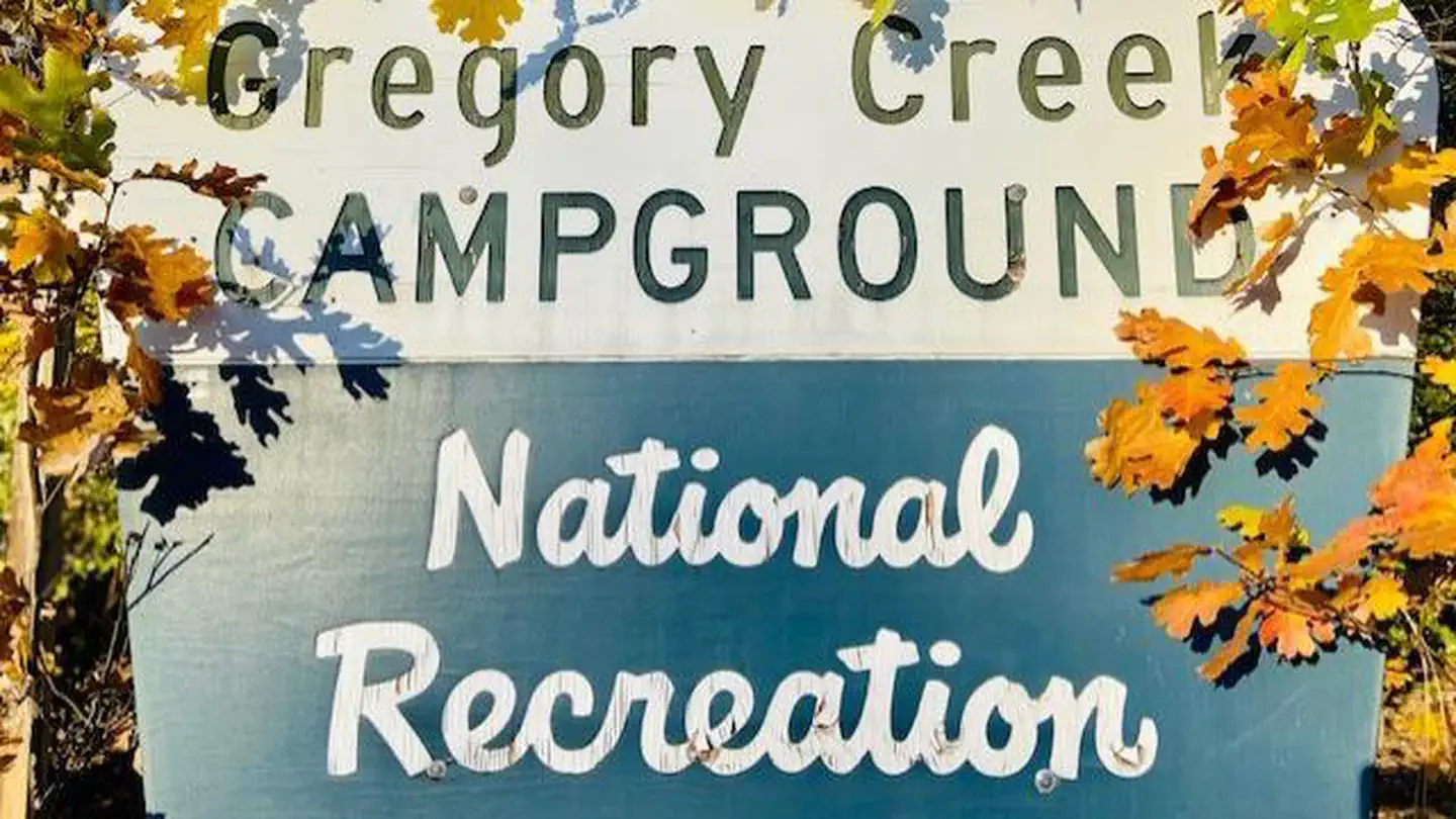
The campground sign · Official Recreation.gov / USFS photo
Length limit
16 ft
Cell signal
Sources contradict each other on T-Mobile specifically. The Dyrt's crowd-verified data, dated August 2026, shows AT&T 5G good, Verizon LTE good and T-Mobile 5G excellent. Campflare says AT&T and Verizon available but T-Mobile none. Campers at Gregory Beach next door reported Verizon and T-Mobile both strong enough to work online. On balance expect usable signal, but do not count on any one carrier.
Boat launch
No ramp on site. The Forest Service and Recreation.gov both say only that there is a boat ramp nearby at Antlers — and no authoritative road mileage exists. The geography is worth understanding: Antlers is at I-5 exit 702 on the west side of the Sacramento Arm, while Gregory Creek is four miles up a canyon from exit 698 on the east side. They are close across the water and considerably further by road, since you must return to the freeway and go up one exit. Antlers works until the lake is 75 ft down, then launching shifts to Sugarloaf.
Shade score
5 / 5
Season
May 10 – Sep 12
Elevation
1085 ft
I-5 · Route 5 to O'Brien Rest Area - Northbound
Full · Rest Area Closure · All lane(s) — Active now (Pacific)
I-5 · 1.1 mi south of Antlers Rd (Lakehead) to Lakeshore Dr/Antlers Rd
Lane · Bridge Work · 1, 2 lane(s) — Active now, until Oct 12, 12:01 PM (Pacific)
I-5 · 1.1 mi south of Antlers Rd (Lakehead) to Lakeshore Dr/Antlers Rd
Lane · Bridge Inspection · 2 lane(s) — Oct 12, 5:01 AM – Oct 16, 3:01 PM (Pacific)
I-5 · 0.6 mi south of Gibson Rd to 0.2 mi north of Pollard Flat
Lane · Slide Repair · 2 lane(s) — Oct 12, 7:01 AM – Oct 12, 4:01 PM (Pacific)
Source: Caltrans. County roads (e.g. Gilman Rd, Lakeshore Dr) aren't covered by this feed.
Keyed to this campground's own coordinates, not to the lake. Each item carries the timestamp its source published.
No active National Weather Service alert covers this campground right now.
Forecast: National Weather Service · issued Pacific
Fork Fire15.1 miles away
59 acres · 95% contained
Updated Oct 10, 7:29 AM Pacific
Published · CAL FIRE
Campfire and stove rules change through the season. Read the current forest order before you pack a fire pan — we link it rather than paraphrase it.
Published · USDA Forest Service, Shasta-Trinity alert: 2026 fire restrictions lifted
Readings belong to the water body, not to one campground, and each one carries the timestamp its own source published.
Lake level
979.37ft above sea level
Checked California Data Exchange Center (gauge SHA)
Percent of capacity
52.9% of capacity
Checked California Data Exchange Center (gauge SHA)
| Ramp | Observed status | Usable above | Calculated from lake level |
|---|---|---|---|
| Antlers Public Boat Ramp | closedobserved | 992 ft | below its usable floorcalculated from the 979.37 ft lake level read — not an on-site observation |
| Bailey Cove Public Boat Ramp | closedobserved | 1017 ft | Closed by agency orderClosed by USFS Forest Order 14-25-11: Bailey Cove Road (Forest Road No. 34N40Y) is closed from Shasta Caverns Road to the boat ramp because the area is undergoing construction from two failed culverts. Contact (530) 226-2500. In force through . Credit: USDA Forest Service order |
| Centimudi Public Boat Ramp | openobserved | 857 ft | usablecalculated from the 979.37 ft lake level read — not an on-site observation |
| Hirz Bay Public Boat Ramp | openobserved | 972 ft | close to its floorcalculated from the 979.37 ft lake level read — not an on-site observation |
| Jones Valley Public Boat Ramp | openobserved | 857 ft | usablecalculated from the 979.37 ft lake level read — not an on-site observation |
| Packers Bay Public Boat Ramp | openobserved | 952 ft | usablecalculated from the 979.37 ft lake level read — not an on-site observation |
| Sugarloaf Public Boat Ramp | openobserved | 907 ft | usablecalculated from the 979.37 ft lake level read — not an on-site observation |
Every ramp's page: today's status, lanes, parking and directions
See every lake level, ramp and camera on the conditions dashboard
Camera operated by Caltrans District 2
Frame refreshes about every 5 min · feed last verified
Useful for road surface, smoke and haze — not for checking your site.
| Facility type | Group site · Tent & RV |
|---|---|
| Sites | 18 |
| Max rig | 16 ft |
| Where to book | Recreation.gov |
| Rate | $160 / night |
| Season | May 10 – Sep 12 |
No ramp on site. The Forest Service and Recreation.gov both say only that there is a boat ramp nearby at Antlers — and no authoritative road mileage exists. The geography is worth understanding: Antlers is at I-5 exit 702 on the west side of the Sacramento Arm, while Gregory Creek is four miles up a canyon from exit 698 on the east side. They are close across the water and considerably further by road, since you must return to the freeway and go up one exit. Antlers works until the lake is 75 ft down, then launching shifts to Sugarloaf.
A single group unit on the east shore of the Sacramento Arm, four miles up Salt Creek Road from Interstate 5, taking up to 100 people and 20 vehicles. The Forest Service describes one loop of 18 site pads, moderately to thickly wooded with a mix of oak and pine giving over 80 percent canopy cover — the shadiest campground on this arm. Each site has a picnic table, fire ring, grill and tent pad on a paved back-in spur. Flush toilets. The Forest Service states that potable water is not available, though Recreation.gov says drinking water is provided. No hookups, no showers, no dump station. Recreation.gov records the site as lakefront. Reservable as one unit only, May 10 to September 12, and gated — call for the combination a week ahead.
Sponsored · Outdoorsy
Gregory Creek Group Campground takes rigs up to 16 ft. Owners in the area rent these out on Outdoorsy.
CampSiteHQ earns a commission if you book through these links. Owners set their own nightly rates on Outdoorsy; fees, taxes and delivery are added at checkout.
From Interstate 5 take exit 698, signed Salt Creek/Gilman Road, turn LEFT at the end of the off ramp and follow Salt Creek Road — also signed Gregory Creek Road — for four miles. One guide says four and a half and puts the campground 22 miles north of Redding. Note the direction carefully, because this one exit serves three different destinations. Turn left and go north on Salt Creek Road for Gregory Creek. Turn right and go east on Gilman Road for the entire McCloud Arm. Go west about a mile for Nelson Point. It is easy to commit to the wrong one in the dark. Ignore one line on the Forest Service's own page. It states that the campground is 15 miles northeast of I-5 on Gilman Road, which cannot be reconciled with the "follow Salt Creek Road for 4 miles" in the very next sentence. The same 15-mile sentence appears verbatim on the Gregory Beach page, so it reads as boilerplate copied across the district's Gilman Road sites. Four to four and a half miles is the figure to use. The four miles from the freeway to the campground are paved, per campers who have driven it. What they describe as rough — dirt, rocks, washboard, deep ruts, almost single lane with a precarious cliff section — is the spur that continues down to Gregory Beach, past the campground. Do not transfer those reports onto your approach. That said, the paved road is winding, narrow and unlit by the same accounts, and with a 16-to-20-foot spur limit and back-in-only paved parking this is not a big-rig destination. Call 530-275-8113 at least a week ahead for the gate code. There is a locked gate and no way around it. Bring your own drinking water regardless of what any source says about the taps here — the Forest Service says there are none. There is no dump station. Plan on storing food in your vehicle, since no official page lists bear boxes at this campground.
40.88797, -122.36815 · Driving directions
2 more photos
First, an ambiguity worth clearing up, because it trips people up. The Forest Service's Recreation Facilities Guide lists "Gregory Creek" with 18 sites, while Recreation.gov sells something called "Gregory Creek Group". These are the same place. Recreation.gov offers exactly one bookable campsite — Site 001, the whole loop — and the 18 is the number of individual pads inside it. There is no separate family campground here. Gregory Beach, on the shoreline nearby, is a different thing again: undesignated dispersed camping, first-come, pay on site, and that is where the swimming beach is. What you are booking is the shadiest campground on the Sacramento Arm, and the Forest Service is specific about it: moderately to thickly wooded with a mix of oak and pine that provide plenty of shade during the summer, over 80 percent cover. Recreation.gov's site record simply reads "Shade: Full". On an arm that bakes, that is the single best reason to choose it. The Forest Service is equally specific about what grows underneath — manzanita, blackberries, poison oak, tree fern, wild grape and native grasses. Poison oak is in the campground's own understory, not a general forest warning. It is also candid about privacy, which is rare. Recreation.gov's point-of-interest page says the understory provides limited privacy between sites. One listing puts it less diplomatically: campsites are close and cuddly. For a hundred people in one loop, that is probably the point. Two things to sort out before you go. The gate: Recreation.gov's instruction is to call 530-275-8113 one week before arrival for the entry gate code. And the water, which is the sharpest conflict on this page — the Forest Service states that potable water is not available at this site, while Recreation.gov lists drinking water and four other sources agree with Recreation.gov. Worth knowing that the Forest Service says the same "no potable water" line about Antlers, Lakeshore East and Nelson Point too, so this looks like a district-wide change its own pages have made and Recreation.gov has not mirrored. Arrive with water and treat a working tap as a bonus. Bear boxes are the other gap. Neither official page lists them here, which is conspicuous because the Forest Service pages for Nelson Point and Antlers both name bear boxes explicitly in their facility lists. Absence of mention is not proof of absence, but plan to store food in a hard-sided vehicle. There are no reviews of this campground. The Dyrt has two listings for it and both are empty, Hipcamp has none, Campflare has none, CampsitePhotos has no photos at all. The only real camper reporting in this area is for Gregory Beach next door, and it is about the beach and the road down to it rather than the campground. One rule for the group: no amplified sound.
Gregory Creek sits on the east shore of the Sacramento Arm, four miles up a canyon from Interstate 5 — the busiest and most developed arm of Shasta Lake, though this campground is far enough up Salt Creek Road to be out of the immediate freeway corridor. Among its neighbours it is the group-only option and the shady one. Antlers and Lakeshore East are family campgrounds taking 30-foot rigs; Nelson Point is a hybrid with vault toilets and no water; Gregory Beach is undesignated shoreline. Gregory Creek is the only campground on this shore that books as a single unit for up to 100 people, and at over 80 percent canopy it is comfortably the shadiest of them. It is also genuinely lakefront by Recreation.gov's own site attribute, where the Forest Service says of Antlers that direct access to the water is very difficult. On the shoreline itself the Forest Service is unusually candid about what drawdown does: when the lake level is high the bank is moderately sloped to provide access to the water, and as the lake level drops it exposes a step drop off to the water. Recreation.gov adds that the drop-off is particularly pronounced near Gregory Beach. No source gives a distance from the sites to the waterline at any level. Check the live level at the top of this page. Campers at Gregory Beach in 2022 described the lake as about 150 feet below normal, which is the kind of season that turns a sloped bank into a cliff. Is there actually a creek? The campground is named for the drainage and there is a Gregory Creek inlet where it meets the lake, but no source we could find describes the creek itself or whether it runs through the summer. We would rather say so than guess. The season carries an unusual caveat. The Forest Service notes that the operating season is subject to change for bald eagle habitat protection, citing Forest Order 14-58-40. We could not locate the text of that order — it does not appear on the current alerts index — so its scope and dates are unverified. Shasta Lake holds around 30 nesting pairs and the nesting season runs January through July. The 2021 Salt Fire came through this drainage. It started on 30 June at Gilman Road and Coal Creek Road, burned 12,660 acres and destroyed 41 structures before containment on 19 July. Incident updates described fire activity concentrated around the Salt Creek and Gregory Creek areas east of Interstate 5, and Gregory Creek Road was closed at the I-5 overcrossing with residents evacuated. Evacuation orders for Gregory Creek were lifted on 9 July 2021. Whether the campground itself was damaged, no source we found records — and we are not going to assert either way. What we can say is that it was listed in Exhibit A of the 2026 fire restrictions order (terminated Oct 2, 2026) as an active developed site where campfires remained permitted, it has a published 2026 season, and no current Forest Service alert affects it. The 2018 Delta and Hirz fires burned in the wider region but no source connects either to this drainage.
From campers who stayed here. Every review comes from a signed-in camper and gets a quick check before it goes live.
No reviews yet
Be the first camper to say how Gregory Creek Group Campground worked for your rig.
Write the first reviewOne. The Forest Service's Recreation Facilities Guide lists "Gregory Creek" with 18 sites while Recreation.gov sells "Gregory Creek Group" — these are the same place. Recreation.gov offers exactly one bookable campsite, Site 001, which is the whole loop; the 18 is the number of individual pads inside it. There is no separate family campground. Gregory Beach nearby is a different thing entirely: undesignated dispersed shoreline camping, first-come, pay on site, and where the swimming beach is.
Yes. Recreation.gov's instruction is to call 530-275-8113 one week before arrival for the entry gate code. There is a locked gate and no way around it. Moore Creek, Pine Point, Nelson Point and Dekkas Rock all work the same way — the gate is standard for Shasta Lake group camps rather than a quirk of this one.
Sources contradict each other and we cannot settle it. The Forest Service states plainly that potable water is not available at this site. Recreation.gov lists drinking water under facilities, and Campflare, Hipcamp, The Dyrt and one guide all agree with Recreation.gov. Worth knowing that the Forest Service says the same no-water line about Antlers, Lakeshore East and Nelson Point, so this looks like a district-wide change its pages have made and Recreation.gov has not mirrored. Arrive with water.
It is the shadiest campground on this arm, and the Forest Service is specific: one loop, moderately to thickly wooded with a mix of oak and pine that provide plenty of shade during the summer, over 80 percent cover. Recreation.gov's site record simply reads Shade: Full. The understory is manzanita, blackberries, poison oak, tree fern, wild grape and native grasses — note the poison oak is in the campground itself, not just the surrounding forest.
Not very, and the Forest Service says so. Recreation.gov's point-of-interest page states that the understory provides limited privacy between sites, and one listing describes the campsites as close and cuddly. With 18 pads in a single loop taking up to 100 people, closeness is somewhat the point. There is one rule to pass on to your group: no amplified sound.
The two authoritative sources disagree. The Forest Service's Recreation Facilities Guide says 16 feet; Recreation.gov's own site record says a maximum vehicle length of 20. Campflare says 24 and Roadtrippers says 30, neither traceable to an official page. We publish 16 as the conservative figure. Both agree on the shape of it: paved spurs, back-in only, slight grade, no pull-throughs. Campflare puts it plainly — not big rig friendly.
$160 a night for the whole campground per the Forest Service; four other sources say $170, and Recreation.gov shows no price until you enter dates. Budget for $170. The Facilities Guide's $140 is stale — the same document lists Antlers at $23 where the current page says $28. No official source states an extra-vehicle fee, and with 20 vehicles included in the group rate it may not apply.
From I-5 take exit 698, turn LEFT and follow Salt Creek Road, also signed Gregory Creek Road, for four miles. Note that this one exit serves three destinations: left and north for Gregory Creek, right and east on Gilman Road for the entire McCloud Arm, west about a mile for Nelson Point. Ignore the line on the Forest Service page saying the campground is 15 miles northeast on Gilman Road — it contradicts the next sentence on the same page and appears to be boilerplate copied across the district.
The four miles from the freeway are paved, though winding, narrow and unlit by camper accounts. What gets described as rough — dirt, rocks, washboard, deep ruts, almost single lane with a precarious cliff section — is the spur that continues down to Gregory Beach past the campground, not your approach. Do not confuse the two. With a 16-to-20-foot spur limit and back-in-only parking, this is still not a big-rig destination.
The fire came through this drainage but nobody documents what happened to the campground. The 2021 Salt Fire started on 30 June at Gilman Road and Coal Creek Road, burned 12,660 acres and destroyed 41 structures. Incident updates described fire activity concentrated around the Salt Creek and Gregory Creek areas east of I-5, Gregory Creek Road was closed at the I-5 overcrossing, and evacuation orders for Gregory Creek were lifted on 9 July 2021. No source records damage to the campground. What is certain is that it is listed as an active developed site in the 2026 fire order, has a published 2026 season, and carries no current closure.