
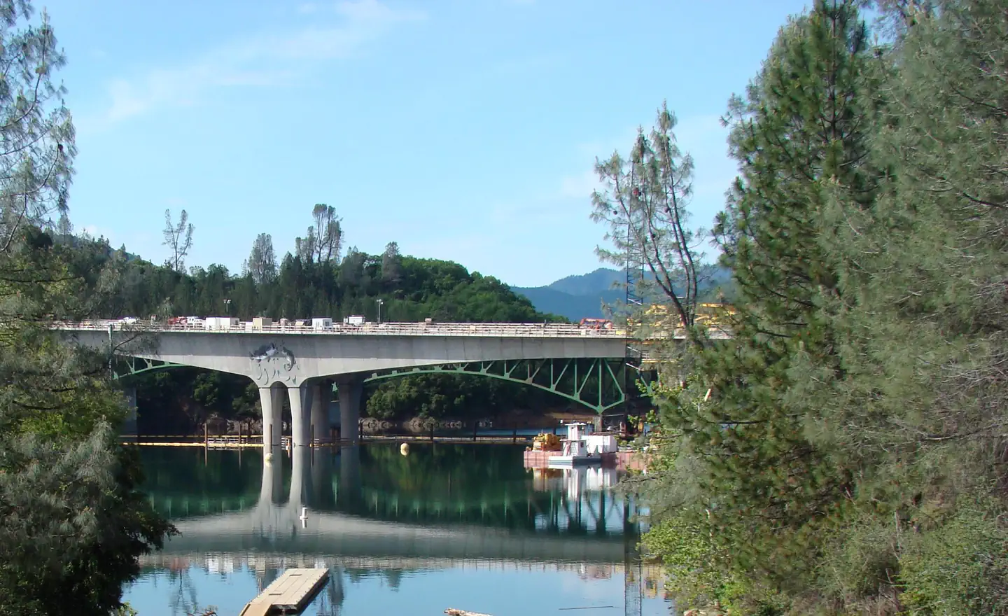
Antlers Bridge · I-5 — about 0.5 mi from the campground
Camera operated by Caltrans District 2

Frame refreshes about every 5 min · feed last verified
Useful for road surface, smoke and haze — not for checking your site.
$28–$58 / night
Campground entrance · Official Recreation.gov / USFS photo
Length limit
55 ft
Cell signal
AT&T and T-Mobile both report 5G and are well corroborated. Verizon is the weak one — the only carrier-specific reports call it two bars or "weak", and there are no Verizon speed tests on file. You are 0.8 miles from I-5, which is why the GSM carriers do well.
Boat launch
Four-lane paved ramp half a mile east of the exit, usable to 75 feet of drawdown. Past 75 ft it closes completely and launching moves to Sugarloaf.
Shade score
4 / 5
Season
Mar 1 – Oct 31
Elevation
1100 ft
I-5 · Route 5 to O'Brien Rest Area - Northbound
Full · Rest Area Closure · All lane(s) — Active now (Pacific)
I-5 · 1.1 mi south of Antlers Rd (Lakehead) to Lakeshore Dr/Antlers Rd
Lane · Bridge Inspection · 2 lane(s) — Active now, until Oct 9, 3:01 PM (Pacific)
I-5 · 1.1 mi south of Antlers Rd (Lakehead) to Lakeshore Dr/Antlers Rd
Lane · Bridge Work · 1, 2 lane(s) — Active now, until Oct 10, 5:01 PM (Pacific)
I-5 · 0.7 mi north of Turntable Bay Rd to 0.7 mi south of Bridge Bay Rd
Lane · Paving Operation · 2 lane(s) — Oct 8, 8:01 AM – Oct 8, 4:30 PM (Pacific)
Source: Caltrans. County roads (e.g. Gilman Rd, Lakeshore Dr) aren't covered by this feed.
Keyed to this campground's own coordinates, not to the lake. Each item carries the timestamp its source published.
No active National Weather Service alert covers this campground right now.
Forecast: National Weather Service · issued Pacific
Fork Fire14.8 miles away
59 acres · 60% contained
Updated Oct 7, 5:09 PM Pacific
Published · CAL FIRE
Campfire and stove rules change through the season. Read the current forest order before you pack a fire pan — we link it rather than paraphrase it.
Published · USDA Forest Service, Shasta-Trinity alert: 2026 fire restrictions lifted
Readings belong to the water body, not to one campground, and each one carries the timestamp its own source published.
Lake level
979.98ft above sea level
Checked California Data Exchange Center (gauge SHA)
Percent of capacity
53.1% of capacity
Last reading California Data Exchange Center (gauge SHA)
| Ramp | Observed status | Usable above | Calculated from lake level |
|---|---|---|---|
| Antlers Public Boat Ramp | closedobserved | 992 ft | below its usable floorcalculated from the 979.98 ft lake level read — not an on-site observation |
| Bailey Cove Public Boat Ramp | closedobserved | 1017 ft | Closed by agency orderClosed by USFS Forest Order 14-25-11: Bailey Cove Road (Forest Road No. 34N40Y) is closed from Shasta Caverns Road to the boat ramp because the area is undergoing construction from two failed culverts. Contact (530) 226-2500. In force through . Credit: USDA Forest Service order |
| Centimudi Public Boat Ramp | openobserved | 857 ft | usablecalculated from the 979.98 ft lake level read — not an on-site observation |
| Hirz Bay Public Boat Ramp | openobserved | 972 ft | close to its floorcalculated from the 979.98 ft lake level read — not an on-site observation |
| Jones Valley Public Boat Ramp | openobserved | 857 ft | usablecalculated from the 979.98 ft lake level read — not an on-site observation |
| Packers Bay Public Boat Ramp | openobserved | 952 ft | usablecalculated from the 979.98 ft lake level read — not an on-site observation |
| Sugarloaf Public Boat Ramp | openobserved | 907 ft | usablecalculated from the 979.98 ft lake level read — not an on-site observation |
Every ramp's page: today's status, lanes, parking and directions
See every lake level, ramp and camera on the conditions dashboard
Camera operated by Caltrans District 2
Frame refreshes about every 5 min · feed last verified
Useful for road surface, smoke and haze — not for checking your site.
| Facility type | Tent & RV |
|---|---|
| Sites | 59 |
| Max rig | 55 ft |
| Where to book | Recreation.gov |
| Rate | $28–$58 / night |
| Season | Mar 1 – Oct 31 |
Four-lane paved ramp half a mile east of the exit, usable to 75 feet of drawdown. Past 75 ft it closes completely and launching moves to Sugarloaf.
Fifty-nine sites — 43 single, 16 double — on a bluff above the Sacramento Arm, in oak, pine and manzanita that give real shade and spacing. There are no hookups, no dump station and no showers; water comes from shared spigots. Three loops run on different calendars: Loop 1 is open March through October, Loops 2 and 3 only from May 10 to September 12. An amphitheater hosts weekend interpretive programs between Memorial Day and Labor Day. The Forest Service is direct about the tradeoff: the views are excellent and there is no practical way down to the water.
Sponsored · Outdoorsy
Antlers Campground takes rigs up to 55 ft. Owners in the area rent these out on Outdoorsy.
CampSiteHQ earns a commission if you book through these links. Owners set their own nightly rates on Outdoorsy; fees, taxes and delivery are added at checkout.
From I-5 take exit 702, Lakeshore Drive / Antlers Road, at Lakehead. Head east off the interchange, turn right onto Antlers Road, and follow it just under a mile to the entrance on the right. About 22 miles north of Redding and 35 miles south of Mount Shasta. Paved the whole way, including every parking spur. The one hazard worth planning around is inside the campground, not on the road in. A full-timer in a 40-foot coach describes one tight tree-bordered turn at the beginning of the campground and calls it not really doable for anything bigger than 40 feet. A traveller in a truck camper said he would have been extremely nervous attempting it with a 28-foot fifth wheel. At 35 feet you are fine. At 40 you are at the documented limit. Know your specific site length before you commit, because they are not uniform — 22 feet to 55 feet across the campground, and the loop layout does not follow site numbering. Every site is back-in; there are no pull-throughs. Sites rated 45 feet or more are 023, 025, 027, 029, 035, 037, 038, 039, 043, 046 and 050. Do not arrive after dark. More than one camper reports it being hard to find the entrance at night. And arrive with full fresh water and empty tanks — there are no hookups, no dump station and no showers, and campers report the shared spigots will not take a hose.
40.88904, -122.37551 · Driving directions
7 more photos
Three loops, three different seasons, and Recreation.gov hides which loop a site is in — the loop number only appears buried in each site's description text. Loop 1 is the shoulder-season loop, the only one open in March, April and October. Loops 2 and 3 run May 10 to September 12 only. Loop 2 is the best all-round loop. Six of its fourteen sites are explicitly described as shady, it holds the only two sites described as being near the trail to the lake view — 015 and 018 — and it contains site 046, the longest in the campground at 55 feet. Loop 3 is the big-rig loop, with four sites at 50 feet plus 029 and 035 at 45. Site 037 in Loop 3 gets singled out as very spacious and isolated. Loop 1 is where the freeway complaints cluster. The three angriest reviews about I-5 name sites 4, 5 and 9, and all three are Loop 1. Site 059 is literally described as "near exit". If you are booking Loop 1 for the shoulder season, take the noise seriously. The sixteen doubles are 006, 007, 009, 013, 017, 019, 022, 030, 031, 033, 041, 042, 045, 049, 051 and 057 — that is 16 doubles plus 42 reservable singles plus the host site at 002, which reconciles exactly to the official 59. Site 009 is a double rated for only 22 feet, which is a large group in a small hole. Site 022 is the best big-rig double at 40 feet. Watch the short ones: 009 at 22 feet, then 024, 044 and 058 at 25, and 007 at 26. Sites 034 through 042 along Antlers Road are reported as too uneven for larger rigs, and site 021 has trees close enough to interfere with slides and awnings. The camp hosts get unusually consistent praise here — by name, repeatedly, across years. The host sits at site 002 and sells firewood. Two hazards the Forest Service posts officially: bears frequent the area and every site has a locker, and poison oak grows in the campground. Poison oak is the second most repeated complaint after noise. Add June bugs, mosquitoes, dust, and real heat — this sits at about 1,100 feet, so 90°F in June and worse in July.
Antlers is a viewpoint campground, not a waterfront one, and Recreation.gov says so outright: there is no access to the water from this campground. The Forest Service softens it slightly — some sites border the shoreline but direct access is very difficult. What sits between you and the lake is a bluff of steep rock, and at drawdown the gap grows by exactly however far the lake has dropped. In late August 2026 that was about 75 feet of additional exposed, steep bank. Two sites, 015 and 018, are described as near a trail to view the lake. That is a view, not a route down. If you want to swim, drive. Locals point to the Sugarloaf ramp area when the lake is high, Charlie Creek toward Lakehead as the most drawdown-resistant option, and Gregory Creek off exit 698 down to about 60 feet of drawdown. The Antlers ramp is a four-lane paved launch half a mile east of the exit, and it works down to 75 feet of drawdown — then it stops entirely. There is no partial service. Past 75 feet, launching moves to the Sugarloaf low-water ramp, which runs from 75 all the way to 160 feet down. Full pool is 1,067 feet, so Antlers goes out of service around 992 feet. Check the live lake level on this page before you tow. Then there is the noise, which is the defining feature of camping here. Recreation.gov posts it as an official notice: the campground is right off I-5 and trains are frequent. Freeway noise carries through every loop. The trains are the worse half — one camper logged three during the night, including one that stopped near the campground for thirty minutes at 3am. Another describes train activity around the clock plus periodic diesel smell from the adjacent rail access. Plenty of people say it never bothered them. But there is no quiet corner here, and if silence is why you camp, this is the wrong campground at any price. For boaters: a Forest Service order against golden and zebra mussels covers Shasta Lake and its ramps from December 2025 to December 2027. Clean, drain and dry, and expect to need certification to launch.
From campers who stayed here. Every review comes from a signed-in camper and gets a quick check before it goes live.
No reviews yet
Be the first camper to say how Antlers Campground worked for your rig.
Write the first reviewNo. Recreation.gov states plainly that there is no access to the water from this campground — it sits on a bluff above the Sacramento Arm. The Forest Service says some sites border the shoreline but direct access is very difficult. Two sites, 015 and 018, are near a trail to a lake viewpoint, but that is a view, not a way down. For swimming, drive to Sugarloaf, Charlie Creek or Gregory Creek.
Bad, and it is the most consistent complaint on every review platform. Recreation.gov posts an official notice that the campground is right off I-5 and trains are frequent. Freeway noise carries through all three loops, and the freight line adds night events — one camper logged three trains in a single night, one of which stopped nearby for thirty minutes at 3am. Bring earplugs, or book somewhere else.
Per-site limits run from 22 feet at site 009 to 55 feet at site 046, so check your specific site rather than any campground average. Every site is back-in. The real limit is one tight tree-lined turn at the campground entrance, which a full-timer in a 40-foot coach called the practical ceiling. At 35 feet you are comfortable; at 40 you are at the edge.
No hookups of any kind, no dump station and no showers. Drinking water comes from shared spigots, not at the sites, and campers report the spigots will not accept a hose — bring jugs. The Forest Service page and Recreation.gov contradict each other on whether potable water is currently available, so call 530-275-8113 before you rely on it. Toilets are a mix of flush and vault, and the flush ones are limited.
Loop 1 runs March 1 through October 31. Loops 2 and 3 only run May 10 through September 12. Most listing sites get this wrong and claim the campground is open year-round — it is not. If you are booking in March, April or October you are booking Loop 1, which is also the loop nearest the freeway.
Through Recreation.gov, facility 232753, or by phone at 877-444-6777, on a rolling six-month window. All 58 numbered sites are reservable; site 002 is the camp host. Check-in is 3pm and check-out 2pm. Rates are $28 single and $58 double per the Forest Service, with $12 per extra vehicle, and half price with a Senior or Access Pass.
It runs four lanes until the lake drops 75 feet below full pool, then closes completely — there is no partial service. Full pool is 1,067 feet, so the cutoff is around 992 feet. Below that, launching moves to the Sugarloaf low-water ramp, which works from 75 down to 160 feet of drawdown. Check the live lake level at the top of this page. Day use is $17 to $18 per vehicle.
Yes for AT&T and T-Mobile, both of which are well reported at 4G and 5G. Verizon is the weak one — the only carrier-specific reports describe about two bars, and there are no Verizon speed tests on record here. Being 0.8 miles from I-5 is why the signal is as good as it is.
About 22 miles north on I-5, roughly 25 minutes, at exit 702. The Forest Service says 22 miles, Recreation.gov says 25 — the spread is just different endpoints in Redding. Lakehead has restaurants, markets and gas right at the exit, which is part of why this is such a common I-5 overnight stop.
Both, and both are posted officially by Recreation.gov. Bears frequent the area and every site has a bear-proof food locker — use it. Poison oak grows throughout the campground and is the second most common complaint after noise, with campers reporting it at individual sites. Add June bugs, mosquitoes and real heat: this sits at about 1,100 feet and hits 90°F in June.