
Salt Creek · I-5 — about 6.7 mi from the campground
Camera operated by Caltrans District 2

Frame refreshes about every 4 min · feed last verified
Useful for road surface, smoke and haze — not for checking your site.
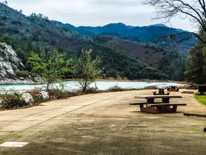
McCloud Arm · Shasta Lake Corridor · 40.91584, -122.24163
$28 / night
Ellery Creek · Official Recreation.gov / USFS photo
Length limit
40 ft
Cell signal
No service
Boat launch
No ramp at the campground. The nearest is Hirz Bay, about 4 miles back down Gilman Road (Recreation.gov says 4, one guide says 5), with a $17 launch fee. Informal shore mooring is allowed at the campground itself when the lake is high enough — see the FAQ below.
Shade score
4 / 5
Season
Apr 1 – Sep 12
Elevation
1085 ft
I-5 · Route 5 to O'Brien Rest Area - Northbound
Full · Rest Area Closure · All lane(s) — Active now (Pacific)
I-5 · 1.1 mi south of Antlers Rd (Lakehead) to Lakeshore Dr/Antlers Rd
Lane · Bridge Work · 1, 2 lane(s) — Active now, until Oct 12, 12:01 PM (Pacific)
I-5 · 1.1 mi south of Antlers Rd (Lakehead) to Lakeshore Dr/Antlers Rd
Lane · Bridge Inspection · 2 lane(s) — Oct 12, 5:01 AM – Oct 16, 3:01 PM (Pacific)
Source: Caltrans. County roads (e.g. Gilman Rd, Lakeshore Dr) aren't covered by this feed.
Keyed to this campground's own coordinates, not to the lake. Each item carries the timestamp its source published.
No active National Weather Service alert covers this campground right now.
Forecast: National Weather Service · issued Pacific
Fork Fire21.7 miles away
59 acres · 90% contained
Updated Oct 9, 8:39 AM Pacific
Published · CAL FIRE
Campfire and stove rules change through the season. Read the current forest order before you pack a fire pan — we link it rather than paraphrase it.
Published · USDA Forest Service, Shasta-Trinity alert: 2026 fire restrictions lifted
Readings belong to the water body, not to one campground, and each one carries the timestamp its own source published.
Lake level
979.49ft above sea level
Checked California Data Exchange Center (gauge SHA)
Percent of capacity
53% of capacity
Last reading California Data Exchange Center (gauge SHA)
| Ramp | Observed status | Usable above | Calculated from lake level |
|---|---|---|---|
| Antlers Public Boat Ramp | closedobserved | 992 ft | below its usable floorcalculated from the 979.49 ft lake level read — not an on-site observation |
| Bailey Cove Public Boat Ramp | closedobserved | 1017 ft | Closed by agency orderClosed by USFS Forest Order 14-25-11: Bailey Cove Road (Forest Road No. 34N40Y) is closed from Shasta Caverns Road to the boat ramp because the area is undergoing construction from two failed culverts. Contact (530) 226-2500. In force through . Credit: USDA Forest Service order |
| Centimudi Public Boat Ramp | openobserved | 857 ft | usablecalculated from the 979.49 ft lake level read — not an on-site observation |
| Hirz Bay Public Boat Ramp | openobserved | 972 ft | close to its floorcalculated from the 979.49 ft lake level read — not an on-site observation |
| Jones Valley Public Boat Ramp | openobserved | 857 ft | usablecalculated from the 979.49 ft lake level read — not an on-site observation |
| Packers Bay Public Boat Ramp | openobserved | 952 ft | usablecalculated from the 979.49 ft lake level read — not an on-site observation |
| Sugarloaf Public Boat Ramp | openobserved | 907 ft | usablecalculated from the 979.49 ft lake level read — not an on-site observation |
Every ramp's page: today's status, lanes, parking and directions
See every lake level, ramp and camera on the conditions dashboard
Camera operated by Caltrans District 2
Frame refreshes about every 4 min · feed last verified
Useful for road surface, smoke and haze — not for checking your site.
| Facility type | Tent & RV |
|---|---|
| Sites | 19 |
| Max rig | 40 ft |
| Where to book | Recreation.gov |
| Rate | $28 / night |
| Season | Apr 1 – Sep 12 |
No ramp at the campground. The nearest is Hirz Bay, about 4 miles back down Gilman Road (Recreation.gov says 4, one guide says 5), with a $17 launch fee. Informal shore mooring is allowed at the campground itself when the lake is high enough — see the FAQ below.
Nineteen single family sites terraced down a hillside where Ellery Creek runs into the McCloud Arm, roughly 15 miles east of Interstate 5 on Gilman Road. The Forest Service describes the campground as terraced so that all of the lower sites and some of the upper ones have lake views, and at high water the lower tier sits essentially at the waterline. Every site has a picnic table, a fire ring, a paved parking spur and a bear-proof locker. Vault toilets, no flush toilets, no showers, no hookups and no dump station. Season runs April 1 to September 12. Managed by Shasta Recreation Company under the Shasta-Trinity National Forest.
Sponsored · Outdoorsy
Ellery Creek Campground takes rigs up to 40 ft. Owners in the area rent these out on Outdoorsy.
CampSiteHQ earns a commission if you book through these links. Owners set their own nightly rates on Outdoorsy; fees, taxes and delivery are added at checkout.
From Interstate 5 take exit 698 — signed Gilman Road from the south, Salt Creek from the north — turn east and follow Gilman Road along the McCloud Arm. The campground entrance is on the right, between Moore Creek and Pine Point. The mileage is genuinely disputed and the Forest Service page contradicts itself: its header says 15 miles northeast of I-5 while its directions say approximately 11 miles down Gilman Road. Recreation.gov says 16. Two independent guides say 16 and 14. Cross-checked against the neighbours on the same road — Hirz Bay at 10, Dekkas Rock at 12 — and against Recreation.gov's own placement between Moore Creek and Pine Point, plan on 15 to 16 miles. Whatever the number, this is not a quick 15 miles. Campers on the same road consistently report about 30 minutes for the first 10 to Hirz Bay, a sustained 20 miles an hour, which tells you what the curves are like. Add another 15 to 20 minutes to reach Ellery Creek. Redding to the campground is roughly 50 to 55 minutes door to door. Inside the campground everything is paved — the loop road and every parking spur. Gilman Road itself is a paved two-lane forest road, but no source we could find documents its grades, width or towing character in detail, and at least one camper described the roads in as rough and the Forest Service signage as poorly labelled for closures. Take it slow, expect boat-trailer traffic on summer weekends, and do not count on turning a long rig around if you pick the wrong pullout. Arrive with empty holding tanks and full fresh water. There is no dump station here and the nearest is at Lakehead, back out on I-5.
40.91584, -122.24163 · Driving directions
5 more photos
Nineteen sites is small enough that the per-site records matter more here than anywhere else on the arm, and Recreation.gov's own site notes do most of the work for you. Six sites are flagged "lake access": 010, 011, 012, 013, 014 and 016. Three of those — 010, 011 and 012 — also read "near water faucet and restroom," which makes them the practical picks. Site 012 is the only one whose note actually begins "Shady," and it is rated 40 ft. Sites 013, 014 and 016 begin "Sunny," which in a canyon that bakes through July and August is a warning, not a selling point. For length, the four sites above 30 feet are 010 (40 ft), 011 (35 ft), 012 (40 ft) and 019 (40 ft). Eight more are rated exactly 30 — no margin at all — and 001, 002, 017 and 018 top out at 20. If you are towing anything substantial, you are choosing from four sites, and they are the same four everyone else wants. Book on the six-month window. Two per-site cautions worth carrying with you. Recreation.gov flags site 008 as "difficult to back trailer into site." And a camper reported in June 2024 that site 011 will not take a trailer over 20 feet because of a retaining wall on the road — which directly contradicts Recreation.gov's 35 ft rating for that site. Nobody has resolved it. There is no camp host here, and it shows. Campers report two garbage cans for the whole campground and not emptied daily, overfilled trash lockers, and restrooms running out of paper. Bring your own supplies and pack your trash out. One reviewer in 2025 found the bear locker at site 019 unlockable because the key was broken. The most-repeated complaint by a wide margin is mosquitoes — May, June, July, it does not matter, and one camper said bug spray barely helped. Poison oak and blackberries grow inside the sites themselves, not just along the trails. Rattlesnakes have been reported twice in summer. Bears are around: a cub across the creek in July, large prints in August, and lockers at every site for a reason. On water: Recreation.gov lists water spigots and seven site records read "near water faucet," and campers have used them as recently as May 2026. But the Forest Service's own page says flatly that potable water is not available, and one camper in May 2021 found the pumps off. Treat a working tap as a bonus and arrive full.
Ellery Creek is the on-the-water one, and that is the whole case for it. Hirz Bay, four miles back, sits on a hilltop with the lake down a trail — a view campground. Ellery Creek is terraced right down toward the waterline, and at full pool the lower sites are at the water's edge. The Forest Service says all of the lower sites and some of the upper ones have lake views. The reason boaters book it is informal mooring. The Forest Service is specific: when the lake is at its highest, down to approximately 50 feet below full pool, boats can be moored on the shore within sight of the campground. Full pool is 1,067 feet, so that threshold sits at roughly 1,017 feet. Check the live lake level at the top of this page before you plan around it — below that elevation the mooring is gone and you are launching from Hirz Bay instead. What the water looks like at low levels is worth being honest about. Campers describe the walk down as rocky with many small stones, and at lower levels sticky, dense mud rather than a beach. One reviewer recommended floats simply to avoid the mud. At high water the reports flip completely — "went when the lake was high and we were right on the water." This is a campground whose character changes more with the lake level than almost any other on the arm. There is one paradox to know: at true full pool, within about three feet, the best sites are reportedly underwater. Ellery Creek itself passes through the campground on its way into the lake, and campers reference it in July and August, so it is not bone-dry in midsummer. Be aware that when the lake drops, campers often use "the creek" to mean the shrunken lake channel rather than Ellery Creek — the two get conflated in reviews. The other thing that makes this campground unusual: it is the only real family campground between Hirz Bay and McCloud Bridge. Dekkas Rock, Moore Creek and Pine Point are all group facilities — Dekkas Rock and Pine Point require a gate code arranged a week ahead. If you want a reservable family site on the upper McCloud Arm with room for a rig over 24 feet and you are not a group, your choices are Hirz Bay and Ellery Creek, and Ellery is the small quiet one. What you give up against Hirz Bay: flush toilets, a camp host, and being next to the ramp.
From campers who stayed here. Every review comes from a signed-in camper and gets a quick check before it goes live.
No reviews yet
Be the first camper to say how Ellery Creek Campground worked for your rig.
Write the first reviewDepends entirely on the site, and the range is wide. Per-site limits on Recreation.gov run from 20 to 40 feet. Only four sites are rated above 30: sites 010, 012 and 019 at 40 feet, and site 011 at 35. Another eight are rated exactly 30 feet with no margin, and sites 001, 002, 017 and 018 top out at 20. Recreation.gov's headline 30-foot figure is an average, not a limit. Every site is a back-in on a paved spur, and Recreation.gov flags site 008 as difficult to back a trailer into.
Yes, but only when the lake is high. The Forest Service allows informal shore mooring within sight of the campground when the lake is at its highest, down to approximately 50 feet below full pool. Full pool is 1,067 feet, so the threshold is around 1,017 feet of elevation. Check the live lake level at the top of this page — below that, mooring is gone and the nearest ramp is Hirz Bay, about 4 miles back, with a $17 launch fee.
Both, depending on when you go. All 19 sites have bookable Recreation.gov pages on a six-month window, and campers have been booking specific site numbers through 2026. Recreation.gov also posts the campground as open for walk-ins April 1 to September 10. In practice it runs first-come early in the season and reservable through the summer. The four long sites go fast — one guide puts it bluntly: book six months out for the primo sites.
Recreation.gov flags six as lake access: 010, 011, 012, 013, 014 and 016. Sites 010, 011 and 012 also read near water faucet and restroom, which makes them the best all-round picks — and 012 is the only site whose note begins Shady. Sites 013, 014 and 016 are flagged Sunny, which matters in a canyon that regularly hits triple digits.
Probably, but carry your own. Recreation.gov lists water spigots and seven individual site records read near water faucet. Campers have reported working water as recently as May 2026. But the Forest Service's own page says flatly that potable water is not available, and one camper in May 2021 found the pumps off. The infrastructure exists; the land manager's page contradicts it. Arrive full and treat a working tap as a bonus.
No. The Dyrt lists no coverage on Verizon, AT&T and T-Mobile alike, and campers describe it as no cell service for miles. A single 2019 Campendium entry claims signal on all three carriers, but it is one report and not credible for this location. Download maps and reservations before you turn off I-5, and expect no service on the drive in either.
Plan on 15 to 16 miles east on Gilman Road from exit 698, and about 45 minutes for that stretch. The sources genuinely disagree — the Forest Service page says 15 miles in its header and 11 miles in its own directions, Recreation.gov says 16, and two guides say 16 and 14. Recreation.gov places the entrance between Moore Creek and Pine Point, which brackets it at 15 to 17. Redding to the campground is roughly 50 to 55 minutes.
Yes, and it is the single most repeated complaint in the reviews. Campers report them in May, June and July alike, and one said bug spray barely helped. You are camping beside a creek mouth on a reservoir, so it comes with the address. Bring repellent, a screen room if you have one, and expect them worst at dusk. Poison oak and blackberries also grow inside the campsites themselves, and rattlesnakes have been reported twice in summer.
No, and it affects the experience. Campers report two garbage cans for the whole campground and not emptied daily, overfilled trash lockers, and restrooms that ran out of paper and were not restocked. One camper in June 2025 found the bear locker at site 019 could not be locked because the key was broken. Bring your own supplies, check your locker latches on arrival, and pack your trash out.
Hirz Bay is the view campground — 46 sites on a hilltop with flush toilets, a camp host and the boat ramp next door, but the lake is down a trail. Ellery Creek is the on-the-water campground — 19 terraced sites where the lower tier sits at the waterline at high pool, with shore mooring when the lake allows. Ellery is smaller, quieter and closer to the water; Hirz Bay is better equipped and easier to launch from. Ellery also takes longer rigs than anything further out on the arm.