
Salt Creek · I-5 — about 4.9 mi from the campground
Camera operated by Caltrans District 2

Frame refreshes about every 4 min · feed last verified
Useful for road surface, smoke and haze — not for checking your site.
$28–$56 / night
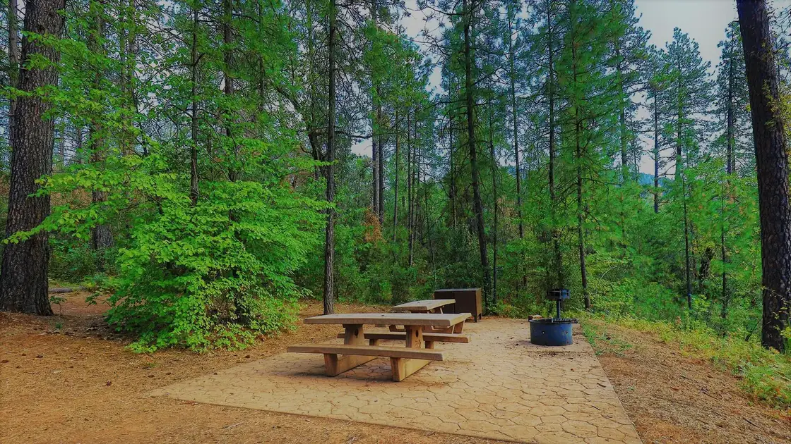
Hirz Bay · Official Recreation.gov / USFS photo
Length limit
50 ft
Cell signal
Poor to none, and it varies by where you stand. Verizon is the least bad — some LTE reported, though one Verizon user reported nothing at all. AT&T and T-Mobile both report no coverage. There is a pay phone on site, which tells you what the operator thinks of the signal.
Boat launch
Hirz Bay ramp, about 1 mile. Three ramps for different lake levels — three lanes to 75 ft of drawdown, two lanes to 95 ft, then closed. 61 lighted parking spaces and a courtesy dock.
Shade score
5 / 5
Season
Open year-round
Elevation
1100 ft
I-5 · Route 5 to O'Brien Rest Area - Northbound
Full · Rest Area Closure · All lane(s) — Active now (Pacific)
I-5 · 1.1 mi south of Antlers Rd (Lakehead) to Lakeshore Dr/Antlers Rd
Lane · Bridge Work · 1, 2 lane(s) — Active now, until Oct 10, 5:01 PM (Pacific)
I-5 · 1.1 mi south of Antlers Rd (Lakehead) to Lakeshore Dr/Antlers Rd
Lane · Bridge Inspection · 2 lane(s) — Active now, until Oct 9, 3:01 PM (Pacific)
I-5 · 0.7 mi north of Turntable Bay Rd to 0.7 mi south of Bridge Bay Rd
Lane · Paving Operation · 2 lane(s) — Active now, until Oct 8, 4:30 PM (Pacific)
I-5 · 1.1 mi south of Antlers Rd (Lakehead) to Lakeshore Dr/Antlers Rd
Lane · Bridge Inspection · 2 lane(s) — Oct 12, 5:01 AM – Oct 16, 3:01 PM (Pacific)
Source: Caltrans. County roads (e.g. Gilman Rd, Lakeshore Dr) aren't covered by this feed.
Keyed to this campground's own coordinates, not to the lake. Each item carries the timestamp its source published.
No active National Weather Service alert covers this campground right now.
Forecast: National Weather Service · issued Pacific
Fork Fire19.9 miles away
59 acres · 75% contained
Updated Oct 8, 6:24 AM Pacific
Published · CAL FIRE
Campfire and stove rules change through the season. Read the current forest order before you pack a fire pan — we link it rather than paraphrase it.
Published · USDA Forest Service, Shasta-Trinity alert: 2026 fire restrictions lifted
Readings belong to the water body, not to one campground, and each one carries the timestamp its own source published.
Lake level
979.95ft above sea level
Checked California Data Exchange Center (gauge SHA)
Percent of capacity
53.1% of capacity
Checked California Data Exchange Center (gauge SHA)
| Ramp | Observed status | Usable above | Calculated from lake level |
|---|---|---|---|
| Antlers Public Boat Ramp | closedobserved | 992 ft | below its usable floorcalculated from the 979.95 ft lake level read — not an on-site observation |
| Bailey Cove Public Boat Ramp | closedobserved | 1017 ft | Closed by agency orderClosed by USFS Forest Order 14-25-11: Bailey Cove Road (Forest Road No. 34N40Y) is closed from Shasta Caverns Road to the boat ramp because the area is undergoing construction from two failed culverts. Contact (530) 226-2500. In force through . Credit: USDA Forest Service order |
| Centimudi Public Boat Ramp | openobserved | 857 ft | usablecalculated from the 979.95 ft lake level read — not an on-site observation |
| Hirz Bay Public Boat Ramp | openobserved | 972 ft | close to its floorcalculated from the 979.95 ft lake level read — not an on-site observation |
| Jones Valley Public Boat Ramp | openobserved | 857 ft | usablecalculated from the 979.95 ft lake level read — not an on-site observation |
| Packers Bay Public Boat Ramp | openobserved | 952 ft | usablecalculated from the 979.95 ft lake level read — not an on-site observation |
| Sugarloaf Public Boat Ramp | openobserved | 907 ft | usablecalculated from the 979.95 ft lake level read — not an on-site observation |
Every ramp's page: today's status, lanes, parking and directions
See every lake level, ramp and camera on the conditions dashboard
Camera operated by Caltrans District 2
Frame refreshes about every 4 min · feed last verified
Useful for road surface, smoke and haze — not for checking your site.
| Facility type | Tent & RV |
|---|---|
| Sites | 46 |
| Max rig | 50 ft |
| Where to book | Recreation.gov |
| Rate | $28–$56 / night |
| Season | Open year-round |
Hirz Bay ramp, about 1 mile. Three ramps for different lake levels — three lanes to 75 ft of drawdown, two lanes to 95 ft, then closed. 61 lighted parking spaces and a courtesy dock.
Forty-six sites — 36 single, 10 double — spread through pine, oak and madrone on a hilltop above the McCloud Arm, ten miles east of Interstate 5 down Gilman Road. It is the largest campground on the arm and the one people pick for space: sites are genuinely far apart and several reviewers describe real privacy. Flush toilets, bear lockers at every site, a pay phone, and an amphitheatre where the Hirz Bay Trail starts. No hookups and no dump station. Open year-round, reservable roughly mid-May to mid-September and first-come the rest of the year.
Sponsored · Outdoorsy
Hirz Bay Campground takes rigs up to 50 ft. Owners in the area rent these out on Outdoorsy.
CampSiteHQ earns a commission if you book through these links. Owners set their own nightly rates on Outdoorsy; fees, taxes and delivery are added at checkout.
From Interstate 5 take exit 698 — signed Gilman Road from the south, Salt Creek from the north. Turn east and follow Gilman Road roughly ten to eleven miles to the campground. Sources disagree on the exact mileage: the Forest Service says nine, the boat ramp guide says ten, Recreation.gov says eleven. Plan on ten or eleven. The number that actually matters is the time. Campers consistently report about thirty minutes for those ten miles — a sustained twenty miles an hour on pavement, which tells you everything about the curves. Expect continuous winding with limited sight lines and effectively nowhere to pass. It is paved the whole way, including the campground loops and every parking spur, and no source reports any gravel or dirt. For a thirty-foot rig there is no published length, width or weight restriction on Gilman Road, and no grade warnings anywhere in the Forest Service record. It is a two-lane forest road that handles a thirty-foot rig fine at a patient pace. The real hazards are the curve count, boat-trailer traffic on summer weekends feeding the ramp's 61 parking spaces, and the fact that the ramp closes in severe weather — which should tell you something about winter conditions on the road in. Arrive with empty tanks and full water. There is no dump station on site and the nearest is about fifteen miles away at Lakehead. About twenty miles northeast of Redding, and roughly forty-five minutes door to door.
40.86644, -122.24936 · Driving directions
7 more photos
Forty-six sites is a lot of choice, and the per-site records reward reading them. Site 9 is the standout for anything long — 50 feet, paved, double-rated, and one of only two true pull-throughs on the whole campground. Site 10 is the other. Everything else is a back-in, and the sites are not all level, so bring blocks. The ten doubles are 9, 20, 27, 29, 35, 36, 40, 42, 45 and 46. Site 27 has a repeat visitor who has booked it three years running and calls it the most spacious. Site 46 gets named for privacy and for sitting close to both water and bathrooms. Site 35 is the only one the Forest Service itself labels secluded — though reviewers also report yellow jackets and bear activity there specifically. Site 45 sits right at the Hirz Bay trailhead. Site 21 is the one people complain about. Twenty-four sites carry a full shade rating, which in a place that regularly hits 100°F is the single most useful filter. Sites 16, 18, 24, 26, 28, 37, 39, 43 and 45 are nearest the trail down to the water. Two things to know before you book. The bears here are habituated and active — one camper watched a roughly 500-pound black bear work the lockers at 4am, another party left early after repeated visits, and several people report finding broken lockers. Check yours on arrival and report it if it does not latch. And the poison oak is genuinely everywhere, including inside the sites, which matters most on the unmaintained scramble down to the lake. The other recurring complaint is late-night noise from other campers. Site 6 is designated as the host site, but reviewers repeatedly describe it as unstaffed, and quiet hours going unenforced. On water: the Forest Service page says no potable water is available, while Recreation.gov says there is, and eighteen individual site records mention a faucet next to the site. Campers report working spigots. The infrastructure is clearly there — but the manager's own page says otherwise, so carry your own and treat a working tap as a bonus. The ranger station is 530-275-1587.
Hirz Bay is the quiet one, and that is not marketing — it is geography. Antlers sits half a mile from exit 702 and Bailey Cove about a mile from exit 695, and both campgrounds are dominated by Interstate 5 noise in review after review. Hirz Bay is ten miles east down Gilman Road, and across six review platforms there is not a single mention of freeway or traffic noise. If road noise is what has put you off Shasta Lake camping, this is the answer. What you trade for it is water access. The campground sits on a hilltop and there is no waterfront site — the lake is down a trail. At or near full pool that is a short walk. At the drawdown Shasta reaches by late summer it becomes a steep descent over exposed red clay and a genuinely strenuous climb back, and campers describe both the ten-minute walk down and the clay that stains everything. Sites 16, 18, 24, 26, 28, 37, 39, 43 and 45 are the ones closest to the trailhead. Worth correcting a figure that circulates: this campground is not 300 feet above the water. Full pool is 1,067 feet and the campground sits around 1,090 — about 25 vertical feet above a full lake. The steepness people describe is drawdown, not elevation. The Hirz Bay ramp is about a mile away and it is one of the better ones on the lake: three separate ramps for different levels, three lanes usable to 75 feet of drawdown and two lanes to 95, then closed. That is far deeper than Bailey Cove at 50 feet or Antlers at 75. Check the live lake level on this page before you tow. The Hirz Bay Trail runs 1.6 easy miles from the campground amphitheatre along the shoreline to Dekkas Rock Campground, crossing several shaded creeks on two bridges with lake views most of the way. One piece of history worth knowing: the 2021 Salt Fire started at the mouth of Gilman Road, near the exit 698 offramp, and Gilman Road residents were evacuated. No source maps the perimeter against the campground itself, and nothing currently restricts access. The area also burned in the 2018 Hirz Fire, which took its name from this bay.
From campers who stayed here. Every review comes from a signed-in camper and gets a quick check before it goes live.
No reviews yet
Be the first camper to say how Hirz Bay Campground worked for your rig.
Write the first reviewAlmost anything. Per-site limits run from 32 to 50 feet, with most sites at 40. Recreation.gov's headline figure of 30 feet is a campground average, not a limit. Site 9 is the best big-rig site at 50 feet, paved, double-rated, and one of only two true pull-throughs — site 10 is the other. Everything else is a back-in, and the sites are not all level, so bring blocks.
Probably, but carry your own. The Forest Service page says no potable water is available; Recreation.gov says there is; and eighteen individual site records mention a water faucet beside the site. Campers report working spigots. The infrastructure exists, but the land manager's own page contradicts it, so arrive self-sufficient. Call 530-275-1587 to check.
No. All 46 sites are standard non-electric — no electric, water or sewer, and no dump station on site. The nearest dump is about fifteen miles away at Lakehead. There are flush toilets, which is better than most campgrounds on this arm, and bear-proof lockers at every site.
Through Recreation.gov, facility 232762, on a six-month window, or by phone at 1-877-444-6777. Reservations run roughly mid-May to mid-September; outside that the campground stays open and runs first-come, first-served. Rates are $28 single and $56 double, with $12 per extra vehicle.
It works deeper than most on the lake. Three lanes stay usable until the lake is 75 feet below full pool, then two lanes until 95 feet, after which it closes. Compare that with Bailey Cove, which shuts at 50 feet, and Antlers at 75. There are 61 lighted parking spaces, a courtesy dock and flush toilets, but no drinking water at the ramp. Check the live lake level at the top of this page.
Barely, and plan on none. Verizon is the least bad with some LTE reported, though one Verizon user reported no service at all. AT&T and T-Mobile both show no coverage. There is a pay phone on site, which tells you what the operator expects. Download maps before you turn off I-5.
Yes, and by a wide margin. Antlers sits half a mile from I-5 and Bailey Cove about a mile, and freeway noise is the top complaint at both. Hirz Bay is ten miles east down Gilman Road, and across six review platforms there is not one mention of traffic noise. The noise complaints here are about other campers and late-night parties — site 6 is the designated host site but reviewers often describe it as unstaffed.
1.6 miles, rated easy, from the campground amphitheatre along the McCloud Arm shoreline to Dekkas Rock Campground. It crosses several cool shaded creeks on two bridges and gives lake views most of the way. Site 45 sits right at the trailhead. Elevation gain is not published.
Yes, but it is a walk. No site is waterfront — the campground is on a hilltop and the lake is down a trail. Near full pool that is a short stroll. At the drawdown Shasta reaches by late summer it becomes a steep descent over exposed red clay and a hard climb back in 100-degree heat. Campers warn that the clay stains everything.
Yes, and they are habituated. Recreation.gov posts a standing alert to keep all food in the lockers. One camper watched a roughly 500-pound black bear working the lockers at 4am; another party left early after repeated visits. Several reviewers report finding broken lockers, so check yours latches when you arrive and report it if it does not. Poison oak is also abundant, including inside the sites.