
O'Brien · I-5 — about 0.7 mi from the campground
Camera operated by Caltrans District 2

Frame refreshes about every 5 min · feed last verified
Useful for road surface, smoke and haze — not for checking your site.
McCloud Arm · Shasta Lake Corridor · 40.80030, -122.31915
$28–$60 / night
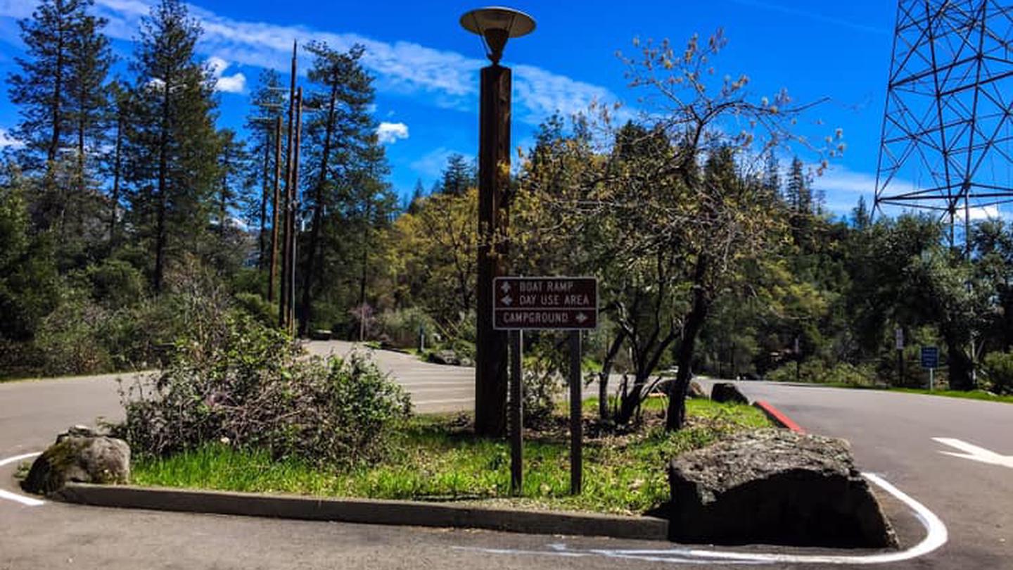
Bailey Cove Campground · Official Recreation.gov / USFS photo
Length limit
45 ft
Cell signal
Unusually good for a national forest campground, because you are 0.6 miles from I-5. AT&T runs 4G/5G, T-Mobile 5G tests as high as 600 Mbps, Verizon is the weak one at about one bar — enough to talk and text.
Boat launch
Two-lane paved ramp beside the campground, but usable only to 50 feet of drawdown — the shallowest cutoff of any major ramp on Shasta Lake.
Shade score
4 / 5
Season
Open year-round
Elevation
1085 ft
The Forest Service is issuing a Forest Order for public safety to close Forest Road No. 34N40Y (Bailey Cove) and Forest Road No. 34N40YA on the Shasta Lake Ranger District within the Shasta-Trinity National Forest. These roads are in an area undergoing construction from two failed culverts.
USDA Forest Service, Shasta-Trinity National Forest, Order 14-25-11
I-5 · Route 5 to O'Brien Rest Area - Northbound
Full · Rest Area Closure · All lane(s) — Active now (Pacific)
I-5 · 1.1 mi south of Antlers Rd (Lakehead) to Lakeshore Dr/Antlers Rd
Lane · Bridge Work · 1, 2 lane(s) — Active now, until Oct 10, 5:01 PM (Pacific)
I-5 · 1.1 mi south of Antlers Rd (Lakehead) to Lakeshore Dr/Antlers Rd
Lane · Bridge Inspection · 2 lane(s) — Active now, until Oct 9, 3:01 PM (Pacific)
SR-151 · 0.5 mi east of Shasta Dam to Sacramento St
One-Way Traffic · Grinding and Paving · 1, 2 lane(s) — Active now, until Oct 8, 5:59 PM (Pacific)
I-5 · 0.7 mi north of Turntable Bay Rd to 0.7 mi south of Bridge Bay Rd
Lane · Paving Operation · 2 lane(s) — Active now, until Oct 8, 4:30 PM (Pacific)
SR-151 · 0.5 mi east of Shasta Dam to Sacramento St
One-Way Traffic · Grinding and Paving · 1, 2 lane(s) — Oct 9, 6:01 AM – Oct 9, 2:59 PM (Pacific)
I-5 · 1.1 mi south of Antlers Rd (Lakehead) to Lakeshore Dr/Antlers Rd
Lane · Bridge Inspection · 2 lane(s) — Oct 12, 5:01 AM – Oct 16, 3:01 PM (Pacific)
SR-151 · Shasta Dam to Sacramento St
One-Way Traffic · Paving Operation · 2 lane(s) — Oct 12, 6:01 AM – Oct 12, 5:59 PM (Pacific)
SR-151 · Shasta Dam to Sacramento St
One-Way Traffic · Paving Operation · 2 lane(s) — Oct 13, 6:01 AM – Oct 13, 5:59 PM (Pacific)
SR-151 · Shasta Dam to Sacramento St
One-Way Traffic · Grinding Operation · 2 lane(s) — Oct 15, 6:01 AM – Oct 15, 5:59 PM (Pacific)
Source: Caltrans. County roads (e.g. Gilman Rd, Lakeshore Dr) aren't covered by this feed.
Keyed to this campground's own coordinates, not to the lake. Each item carries the timestamp its source published.
No active National Weather Service alert covers this campground right now.
Forecast: National Weather Service · issued Pacific
Fork Fire15.1 miles away
59 acres · 75% contained
Updated Oct 8, 6:24 AM Pacific
Published · CAL FIRE
Campfire and stove rules change through the season. Read the current forest order before you pack a fire pan — we link it rather than paraphrase it.
Published · USDA Forest Service, Shasta-Trinity alert: 2026 fire restrictions lifted
Readings belong to the water body, not to one campground, and each one carries the timestamp its own source published.
Lake level
979.95ft above sea level
Checked California Data Exchange Center (gauge SHA)
Percent of capacity
53.1% of capacity
Checked California Data Exchange Center (gauge SHA)
| Ramp | Observed status | Usable above | Calculated from lake level |
|---|---|---|---|
| Antlers Public Boat Ramp | closedobserved | 992 ft | below its usable floorcalculated from the 979.95 ft lake level read — not an on-site observation |
| Bailey Cove Public Boat Ramp | closedobserved | 1017 ft | Closed by agency orderClosed by USFS Forest Order 14-25-11: Bailey Cove Road (Forest Road No. 34N40Y) is closed from Shasta Caverns Road to the boat ramp because the area is undergoing construction from two failed culverts. Contact (530) 226-2500. In force through . Credit: USDA Forest Service order |
| Centimudi Public Boat Ramp | openobserved | 857 ft | usablecalculated from the 979.95 ft lake level read — not an on-site observation |
| Hirz Bay Public Boat Ramp | openobserved | 972 ft | close to its floorcalculated from the 979.95 ft lake level read — not an on-site observation |
| Jones Valley Public Boat Ramp | openobserved | 857 ft | usablecalculated from the 979.95 ft lake level read — not an on-site observation |
| Packers Bay Public Boat Ramp | openobserved | 952 ft | usablecalculated from the 979.95 ft lake level read — not an on-site observation |
| Sugarloaf Public Boat Ramp | openobserved | 907 ft | usablecalculated from the 979.95 ft lake level read — not an on-site observation |
Every ramp's page: today's status, lanes, parking and directions
See every lake level, ramp and camera on the conditions dashboard
Camera operated by Caltrans District 2
Frame refreshes about every 5 min · feed last verified
Useful for road surface, smoke and haze — not for checking your site.
| Facility type | Tent & RV |
|---|---|
| Sites | 7 |
| Max rig | 45 ft |
| Where to book | Recreation.gov |
| Rate | $28–$60 / night |
| Season | Open year-round |
Two-lane paved ramp beside the campground, but usable only to 50 feet of drawdown — the shallowest cutoff of any major ramp on Shasta Lake.
Seven sites on the McCloud Arm — five single, two double — with a two-lane paved ramp right beside the campground and the Bailey Cove Loop Trail starting from the day use area. It is the smallest developed campground on the arm, which is why it fills first. Currently no potable water.
Sponsored · Outdoorsy
Bailey Cove Campground is closed right now. For your next trip, owners around the lake rent these out on Outdoorsy.
CampSiteHQ earns a commission if you book through these links. Owners set their own nightly rates on Outdoorsy; fees, taxes and delivery are added at checkout.
From Interstate 5 take exit 695, O'Brien / Shasta Caverns Road. Turn right at the end of the offramp, follow Shasta Caverns Road four tenths of a mile to the Bailey Cove junction on the right, then Bailey Cove Road six tenths of a mile to the campground. About one mile of surface road from the freeway, paved the whole way. Nineteen miles north of Redding, roughly twenty-five minutes. That last six tenths of a mile is the whole problem for a big rig. One camper who has towed for years put it bluntly: steep, narrow and twisty, and someone without a lot of trailer experience should avoid it. Another brought a 31-foot trailer through in October 2024, made it, and still called the road not big-rig friendly. It is doable at 30 feet. It is not relaxing. Every site is a back-in. There are no pull-throughs. At 30 feet or more, target site 1 or site 7 — both rated 45 feet — because sites 2 through 6 are rated 35 and leave you no margin. The asphalt spurs are not level, so bring blocks; site 7 is the exception and sits nearly flat. Parking is tight, extra vehicles are awkward, and the extra vehicle fee is $12 a night. Do not put the Forest Service's Redding administrative address into a navigation app — it will send you to the wrong place. Use the coordinates, or 20086 Bailey Cove Road, Lakehead.
40.80030, -122.31915 · Driving directions
8 more photos
Seven sites, one loop, and they are not equal. Sites 1 and 7 are the two rated for 45 feet; everything else is 35. Site 7 is the best on the loop and it is not close — double-wide, nearly level, two picnic tables, no neighbours on either side, and close to the restrooms. Site 1 is the quiet one, furthest from the freeway. Site 4 is the private one and picks up shade from about 3pm in July. Site 3 is large and shaded by about 4:30pm, and one family has been booking sites 2 and 3 together for over twenty years. Site 5 has a tent pad too small for a real tent — campers have arrived and left. Sites 3 and 4 draw repeat complaints about noise and unclear boundaries. Now the thing every other guide leaves out: you will hear Interstate 5. The campground sits about six tenths of a mile from the freeway with no ridge in between, and jake brakes carry at night. It is the single most common complaint across every review platform, and it is not universal — plenty of people sleep fine — but if quiet is why you camp, book site 1 or go elsewhere. Bring water regardless of what any page says. The Forest Service lists potable water as available; its own day use page for the same complex says it is not; and the concessionaire's site says flush toilets and water spigots in one sentence and "currently has no potable water" in the next. Campers reported an outage through 2022 and 2023 and working flush toilets again in 2026. Call the ranger station at 530-275-1587 before you rely on it. Heat is the real enemy here — 109°F has been logged in August, dropping into the 70s after sundown. Mosquitoes are bad at dusk, poison oak is abundant right up to the sites, and foxtails come in with the dry grass. Bear boxes at every site are not decorative.
Bailey Cove is a boater's campground for the first half of the season and a hiker's campground for the second half, and the reason is the ramp. It works only until the lake drops 50 feet below full pool. Antlers goes to 69, Hirz Bay to 97, Sugarloaf to 160 (907 feet), Centimudi and Jones Valley past 200. Full pool is 1,067 feet, so Bailey Cove's ramp goes out of service around 1,013 to 1,017 feet. In late August 2026 the lake sat at 991.5 feet — more than twenty feet past the cutoff, and a camper in August 2025 described the ramp as just dirt with minimal incline and large potholes. Check the lake level on this page before you tow a boat here. The Forest Service also advises skipping this ramp on summer weekends because of congestion, and pointing at Packers Bay instead. The same drawdown decides whether you can swim. The campground sits about 300 yards from the water even at full pool, so there is never a walk-out-your-tent shoreline. In May and June it is a genuine swimming spot. By late August in a drawdown year it is a steep, muddy walk down to the water, and reviewers have arrived to find the cove dried out entirely. What is reliably good is the Bailey Cove Loop Trail, which starts from the day use area and circles a peninsula. The Forest Service calls it 3.1 miles; GPS tracks come in at 2.7 to 2.9 with 350 to 600 feet of cumulative gain. The best thing about it is the contrast between the two sides — sunny south slope of oak, manzanita and knobcone pine, shaded north side of Douglas fir, incense cedar and ferns, including the rare Shasta maidenhair fern. There is a 270-degree lake viewpoint at the southeast tip looking up the McCloud Arm. Dogs are welcome on leash — Hipcamp's listing says no pets, and that is simply wrong. Watch the drop-offs, and carry water. For boaters: a Forest Service order against golden and zebra mussels covers Shasta Lake and all its ramps from December 2025 to December 2027, with fines up to $5,000. Clean, drain and dry before you launch. One fee to know about before you park. There is no entrance fee anywhere in Shasta-Trinity National Forest — unlike Whiskeytown down the road, where the Park Service charges $25 a vehicle just to come in, nothing is owed here simply for being on the lake. Your campsite fee is the whole of it. But the Bailey Cove Day Use Area, immediately beside this campground, is a separate fee site at $12 per vehicle per day, and the campground page says nothing about it. Dekkas Rock Day Use Area and Fisherman's Point, the other two day-use sites in this corridor, are both free. So Bailey Cove is the one place on Shasta Lake where a camper can walk into an unexpected charge, and it is right here.
From campers who stayed here. Every review comes from a signed-in camper and gets a quick check before it goes live.
No reviews yet
Be the first camper to say how Bailey Cove Campground worked for your rig.
Write the first reviewYes, but only comfortably in two of the seven sites. Sites 1 and 7 are rated for 45 feet; sites 2 through 6 are rated 35. Every site is a back-in — there are no pull-throughs. The real constraint is not the pad but the last six tenths of a mile of Bailey Cove Road, which experienced towers describe as steep, narrow and twisty. A camper towed a 31-foot trailer in successfully in October 2024 and still called it not big-rig friendly.
Bring your own. The design standard is flush toilets and water spigots, and campers reported both working in summer 2026 — but the Forest Service's own pages contradict each other and the concessionaire's site says 'currently has no potable water' in the same paragraph where it lists spigots. There was a confirmed outage through 2022 and 2023. Call the Shasta Lake Ranger Station at 530-275-1587 before you count on it.
No. There are no electric, water or sewer hookups at any site — this is dry camping. There is no dump station at the campground either; the nearest is about a mile east at Holiday Harbor.
Through Recreation.gov, facility 232760, or by phone at 1-877-444-6777. The booking window opens six months ahead. Reservations are only taken May 13 through September 15; outside that window the campground stays open and runs first-come, first-served, with some sites on Scan and Pay, which needs the Recreation.gov app.
Only when the lake is within 50 feet of full pool — the shallowest cutoff of any major ramp on Shasta Lake. Full pool is 1,067 feet, so the ramp stops working around 1,013 to 1,017 feet. Check the live lake level at the top of this page. In late August 2026 the lake was at 991.5 feet and the ramp was unusable.
Yes, and it is unusually good for a forest campground because you are only 0.6 miles from I-5. AT&T runs 4G and 5G, T-Mobile 5G has been measured over 600 Mbps, and Verizon is the weakest at roughly one bar — enough to talk, text and browse.
The Forest Service says 3.1 miles; GPS tracks from AllTrails, Trailforks and Hiking Project come in at 2.7 to 2.9 miles with 350 to 600 feet of cumulative gain. It loops a peninsula from the day use area, rated moderate, open year-round, and best in spring and fall. There are steep drop-offs in places and no drinking water on the trail.
Yes. Dogs are welcome at the campground and on the Bailey Cove Loop Trail, on a leash no longer than six feet in developed areas. Hipcamp's listing for this campground says no pets are allowed — that is incorrect. Watch for poison oak, which grows right up to the sites, and for foxtails in the dry grass.
Year-round, 24 hours a day. Reservations are only available May 13 through September 15; the rest of the year it is first-come, first-served. Some aggregator sites claim it closes for winter — it does not.
Yes, from Interstate 5. The campground sits about six tenths of a mile from the freeway with no ridge between, and truck jake brakes carry through the night. It is the most common complaint across every review platform, though a fair number of campers say it did not bother them. Site 1 is furthest from the freeway and the best bet if you are noise-sensitive.