
Pit River Bridge · I-5 — about 3.4 mi from the campground
Camera operated by Caltrans District 2

Frame refreshes about every 5 min · feed last verified
Useful for road surface, smoke and haze — not for checking your site.
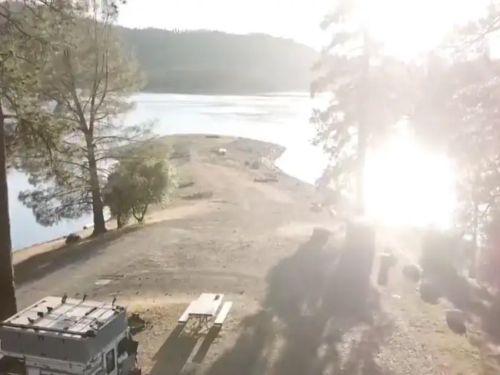
Sulanharas Creek Arm · Shasta Lake Corridor · 40.75248, -122.25361
$130 / night
Mariners Point · USDA Forest Service / Recreation.gov — public domain
Length limit
16 ft
Cell signal
Not published
Boat launch
No ramp at the campground, and no published statement about reaching it by boat — which we would not treat as a way around the road closure, since the slide is an active shoreline movement. Jones Valley Public Boat Ramp is the nearest, roughly 2.1 miles straight-line by our own calculation from the published coordinates; no official source gives a distance. Jones Valley is the most drawdown-tolerant ramp on the lake: four lanes to 50 ft down, two lanes to 140 ft, one lane to about 210 ft. $18 per vehicle per day.
Shade score
4 / 5
Season
Not published
Elevation
1085 ft
I-5 · Route 5 to O'Brien Rest Area - Northbound
Full · Rest Area Closure · All lane(s) — Active now (Pacific)
SR-151 · Shasta Dam to Sacramento St
One-Way Traffic · Paving Operation · 2 lane(s) — Oct 12, 6:01 AM – Oct 12, 5:59 PM (Pacific)
SR-151 · Oregon Ave
Lane · Utility Work · 1 lane(s) — Oct 12, 7:01 AM – Oct 12, 6:01 PM (Pacific)
SR-299 · Dry Creek Rd to 5.5 mi west of Ingot
Lane · Drainage Work · 1 lane(s) — Oct 12, 7:01 AM – Oct 12, 5:30 PM (Pacific)
SR-299 · 0.8 mi west of Oak Run Rd to 1.3 mi west of Oak Run Rd
Lane · Tree Work · Auxiliary lane(s) — Oct 12, 7:01 AM – Oct 12, 4:01 PM (Pacific)
SR-151 · Shasta Dam to Sacramento St
One-Way Traffic · Paving Operation · 2 lane(s) — Oct 13, 6:01 AM – Oct 13, 5:59 PM (Pacific)
SR-299 · Dry Creek Rd to 5.5 mi west of Ingot
Lane · Drainage Work · 1 lane(s) — Oct 13, 7:01 AM – Oct 13, 5:30 PM (Pacific)
SR-299 · 0.8 mi west of Oak Run Rd to 1.3 mi west of Oak Run Rd
Lane · Tree Work · Auxiliary lane(s) — Oct 13, 7:01 AM – Oct 13, 4:01 PM (Pacific)
SR-151 · Oregon Ave
Lane · Utility Work · 1 lane(s) — Oct 13, 7:01 AM – Oct 13, 6:01 PM (Pacific)
SR-151 · Oregon Ave
Lane · Utility Work · 1 lane(s) — Oct 14, 7:01 AM – Oct 14, 6:01 PM (Pacific)
SR-299 · Dry Creek Rd to 5.5 mi west of Ingot
Lane · Drainage Work · 1 lane(s) — Oct 14, 7:01 AM – Oct 14, 5:30 PM (Pacific)
SR-151 · Shasta Dam to Sacramento St
One-Way Traffic · Grinding Operation · 2 lane(s) — Oct 15, 6:01 AM – Oct 15, 5:59 PM (Pacific)
SR-299 · Dry Creek Rd to 5.5 mi west of Ingot
Lane · Drainage Work · 2 lane(s) — Oct 15, 7:01 AM – Oct 15, 5:30 PM (Pacific)
SR-151 · Oregon Ave
Lane · Utility Work · 1 lane(s) — Oct 15, 7:01 AM – Oct 15, 6:01 PM (Pacific)
SR-151 · Shasta Dam to Sacramento St
One-Way Traffic · Grinding Operation · 2 lane(s) — Oct 16, 6:01 AM – Oct 16, 2:59 PM (Pacific)
SR-299 · Dry Creek Rd to 5.5 mi west of Ingot
Lane · Drainage Work · 2 lane(s) — Oct 16, 7:01 AM – Oct 16, 5:30 PM (Pacific)
SR-151 · Oregon Ave
Lane · Utility Work · 1 lane(s) — Oct 16, 7:01 AM – Oct 16, 6:01 PM (Pacific)
Source: Caltrans. County roads (e.g. Gilman Rd, Lakeshore Dr) aren't covered by this feed.
Keyed to this campground's own coordinates, not to the lake. Each item carries the timestamp its source published.
No active National Weather Service alert covers this campground right now.
Forecast: National Weather Service · issued Pacific
Fork Fire18.3 miles away
59 acres · 90% contained
Updated Oct 9, 8:39 AM Pacific
Published · CAL FIRE
Campfire and stove rules change through the season. Read the current forest order before you pack a fire pan — we link it rather than paraphrase it.
Published · USDA Forest Service, Shasta-Trinity alert: 2026 fire restrictions lifted
Readings belong to the water body, not to one campground, and each one carries the timestamp its own source published.
Lake level
979.49ft above sea level
Checked California Data Exchange Center (gauge SHA)
Percent of capacity
53% of capacity
Last reading California Data Exchange Center (gauge SHA)
| Ramp | Observed status | Usable above | Calculated from lake level |
|---|---|---|---|
| Antlers Public Boat Ramp | closedobserved | 992 ft | below its usable floorcalculated from the 979.49 ft lake level read — not an on-site observation |
| Bailey Cove Public Boat Ramp | closedobserved | 1017 ft | Closed by agency orderClosed by USFS Forest Order 14-25-11: Bailey Cove Road (Forest Road No. 34N40Y) is closed from Shasta Caverns Road to the boat ramp because the area is undergoing construction from two failed culverts. Contact (530) 226-2500. In force through . Credit: USDA Forest Service order |
| Centimudi Public Boat Ramp | openobserved | 857 ft | usablecalculated from the 979.49 ft lake level read — not an on-site observation |
| Hirz Bay Public Boat Ramp | openobserved | 972 ft | close to its floorcalculated from the 979.49 ft lake level read — not an on-site observation |
| Jones Valley Public Boat Ramp | openobserved | 857 ft | usablecalculated from the 979.49 ft lake level read — not an on-site observation |
| Packers Bay Public Boat Ramp | openobserved | 952 ft | usablecalculated from the 979.49 ft lake level read — not an on-site observation |
| Sugarloaf Public Boat Ramp | openobserved | 907 ft | usablecalculated from the 979.49 ft lake level read — not an on-site observation |
Every ramp's page: today's status, lanes, parking and directions
See every lake level, ramp and camera on the conditions dashboard
Camera operated by Caltrans District 2
Frame refreshes about every 5 min · feed last verified
Useful for road surface, smoke and haze — not for checking your site.
| Facility type | Group site · Tent & RV |
|---|---|
| Sites | 2 |
| Max rig | 16 ft |
| Where to book | Recreation.gov |
| Rate | $130 / night |
| Season | Not published |
No ramp at the campground, and no published statement about reaching it by boat — which we would not treat as a way around the road closure, since the slide is an active shoreline movement. Jones Valley Public Boat Ramp is the nearest, roughly 2.1 miles straight-line by our own calculation from the published coordinates; no official source gives a distance. Jones Valley is the most drawdown-tolerant ramp on the lake: four lanes to 50 ft down, two lanes to 140 ft, one lane to about 210 ft. $18 per vehicle per day.
USFS: "Campground is closed due to a slide which has caused the road to fail." Located at the opening to the Pit arm of Shasta Lake, two loops taking both tent and RV campers. "Group Site: $130 per night" per loop. "Vault toilet(s)". "Potable water is not available at this site." "Open 24 hours/day". Recreation.gov, facility 273755: "Mariners Point Campground is located where the Pit and Squaw arm of Shasta Lake come together and offers sites to both tent and RV campers." / "All campsites have picnic tables, grills, fire rings, and parking spurs" / "There is no drinking water provided at this facility" / "Call (530) 275-8113 one week before arrival for entry gate code" / "No Amplified Sound!"
Sponsored · Outdoorsy
Mariners Point Group Campground is closed right now. For your next trip, owners around the lake rent these out on Outdoorsy.
CampSiteHQ earns a commission if you book through these links. Owners set their own nightly rates on Outdoorsy; fees, taxes and delivery are added at checkout.
This campground is closed. What follows is the access as published, for whenever the picture changes. The two official sources give different routes. The Forest Service page: from I-5, take the Mountain Gate / Wonderland Boulevard exit, head east to Bear Mountain Road, nine miles to Dry Creek Road, left for a mile, then county road 5J050 for about four miles. Recreation.gov: "From I-5 take the Mountain Gate/Wonderland Blvd. Exit and go east to Bear Mountain Road. At Dry Creek Road go left to Silverthorn Road (take left Y) Follow Silverthorn Road toward the resort and take the left turn prior to entering resort. Campground is behind gate." The operative detail in both is the last one: the campground sits behind a gate, off Silverthorn Road, just short of Silverthorn Resort. It is that gated Forest Service segment — Road 33N85 in the closure order, though the Forest Service's own deleted alert page called it 33N8 — that the slide took out. The Forest Service is inconsistent with itself on the road number and we are publishing both. The rig limit is the other hard constraint and it is not the campground's fault. Sixteen feet, from the Forest Service's 2019 Recreation Facilities Guide. The one camper account that addresses it is blunt: the road up "was insane if you have an rv or 5th wheel... There is nowhere to turn around." Take that seriously if the site ever reopens. When open, the practical checklist was: call Shasta Recreation Company on 530-275-8113 at least a week ahead for the gate code; bring all your drinking water, because there is none here; expect vault toilets; and plan for a two-night minimum at weekends, three on holidays. Recreation.gov's terms also carry the no-amplified-sound rule that runs across this forest's group camps, and ask that firewood be bought locally. There is no published statement about reaching Mariners Point by boat, and we would not treat that as a workaround. The slide is an active shoreline mass-movement — officials in 2022 warned it could "create, basically, a large wave on the lake" — and nothing official addresses boat access to the site. If you want a group camp on this side of the lake right now, Lower Jones Valley and Upper Jones Valley are the open alternatives, both on the Pit arm and both listed in the current fire order.
40.75248, -122.25361 · Driving directions
2 more photos
Mariners Point is closed, and the more interesting fact is that nobody can currently tell you on what authority. The Forest Service's page for the campground carries one sentence: "Campground is closed due to a slide which has caused the road to fail." No date, no order number, no reopening date. The access road was separately shut by Forest Order 14-24-18, the Silverthorn Emergency Closure, signed on 13 August 2024 and effective "from August 14, 2024, through August 14, 2026". That order expired on 14 August 2026. We can find no successor order on the forest's alerts index, and the Forest Service's own alert page for the road closure has been deleted — it returns a 404, while its exact sibling, the Sugarloaf Creek Road closure signed the same day for the same two-year window, is still listed. The campground page, meanwhile, still says closed, and Recreation.gov shows no availability. That is the honest state of it: closed per the only agency page that addresses it, with the enforcing road order lapsed and no published replacement. If this campground matters to your plans, call the Shasta Lake Ranger Station on 530-275-1587 rather than trusting any website, ours included. The slide itself is older than the order and is not a storm story. Local reporting from autumn 2021 documents a landslide at Mariners Point that swallowed the ground under a water pump station serving around 500 Jones Valley customers — the ground had dropped four feet three inches and was still moving. By November 2021 the county's public works director was describing it moving "about an inch and a half a day" and extending the power feed thirty feet to buy a few more weeks. In March 2022 officials attributed the cause to the lake dropping rapidly in drought, on ground already prone to sliding because of ancient geology that predates the reservoir, and warned it would happen again. The Forest Order came almost three years after the slide began, and no published document explains that gap. Note also that Silverthorn Resort, the private marina on the same road, is open and taking bookings, with no road-closure notice anywhere on its site. Recreation.gov's directions place the campground turning immediately before the resort entrance, and the closure order's boundary "begins at the gate across Forest Road 33N85" — which reads as though the county-maintained road to the resort is fine and the gated Forest Service segment beyond it is what failed. No source states that outright, so treat it as our reading rather than fact. What it was when open: two group loops at the confluence of the Pit and Sulanharas Creek arms, taking both tents and RVs, at $130 a night per loop. Recreation.gov documents Loop 1 as taking 50 people and 10 vehicles; Loop 2's capacity is not published anywhere we could find. Vault toilets, picnic tables, fire rings and parking spurs, no drinking water, gate code required a week ahead from 530-275-8113, two-night minimum at weekends and three on holidays, and no amplified sound. The 16-foot rig limit is real — it comes from the Forest Service's own 2019 Recreation Facilities Guide, and a 2020 camper corroborated it the hard way: "The road up to the camp was insane if you have an rv or 5th wheel... There is nowhere to turn around." Two corrections to what we and others had. Our own listing said open year round; the 2019 guide gives the season as 15 May to 11 September, and no official source says year-round. And our note claiming good service on all three carriers was unsourced — no source publishes carrier coverage here at all, so we have removed it.
Mariners Point sits where the Pit arm and the Sulanharas Creek arm of Shasta Lake meet, a couple of miles by water from the Jones Valley ramp. A note on that arm's name. Until 2022 the creek and the arm carried a name built on a slur; the Department of the Interior's Derogatory Geographic Names Task Force retired it in September 2022 and the replacement, Sulanharas, comes from the Wintu language. Recreation.gov has not updated — its overview for this campground still reads "where the Pit and Squaw arm of Shasta Lake come together". The Forest Service's own page avoids the issue by saying only "the Pit arm". We use the current name. No official source publishes a distance to a boat ramp. One aggregator says six miles to Jones Valley without citing anything; measuring straight-line from the published coordinates ourselves gives about 2.1 miles. Jones Valley is the most drawdown-tolerant ramp on the lake — four lanes to 50 feet down, two lanes to 140, one lane to about 210 — so it stays workable deep into a dry summer. That is our arithmetic and their ramp data, not a published distance for this campground. The elevation here, unusually, is solid. The Forest Service's 2019 Recreation Facilities Guide lists Mariners Point at 1,085 feet, which sits sensibly eighteen feet above the lake's full pool of 1,067. That is a real surveyed-looking figure rather than the scraped full-pool number that contaminates most Shasta listings. Competing figures — 1,067 from one aggregator that says outright it computed it from a digital elevation model, 1,057 from another with no source at all — should be ignored. The campground did not appear in Exhibit A of Forest Order 14-26-07, the 2026 fire restrictions order terminated on Oct 2, 2026, which is what you would expect of a site nobody is permitted to reach. Worth flagging one trap: the string "Mariners" does appear in that order, as Mariners Roost — a different site on Trinity Lake in the Weaverville district. Do not let a name match put this campground on the permitted list. We could find no documented origin for the name "Mariners Point" anywhere: not in geographic names records, not in Forest Service material, not in local history writing. A clean blank. On reviews: six exist on one platform, of which two are the same review posted twice, so effectively five. Every one of them dates from June 2020 to June 2021 — all before the slide began. There is no post-closure account anywhere, no photograph of the failed road, and nobody describing arriving to find a gate. That absence is itself the finding. The reviews that do exist describe a quiet, private, spacious site with tables in good shape, a steep hike down to the water that one camper called dangerous for children, and complaints about litter and uncleared poison oak. No wildfire is connected to this campground by any source, so there is no fire history section here. The only fire in the immediate area was a structure fire — the Silverthorn Pizza and Pub, once owned by Merle Haggard, burned down in July 2024. It has not been rebuilt, and the resort confirms there is nothing on the site. That matters for meal planning on the Pit Arm rather than for this campground: there is no longer a restaurant at Silverthorn. Finally, a caution about the rest of the internet. Every aggregator we checked except one is still selling this campground: The Dyrt and PerfectCamp show it as reservable, one service sells cancellation alerts for it, and Campendium lists a $10 nightly rate under the wrong name. Three separate sites quote $110 a night — a figure no official source carries; the Forest Service says $130 and its own 2019 guide said $100. Three sites agreeing on a number nobody official publishes is a copy chain, not corroboration.
From campers who stayed here. Every review comes from a signed-in camper and gets a quick check before it goes live.
No reviews yet
Be the first camper to say how Mariners Point Group Campground worked for your rig.
Write the first reviewNo — but the situation is genuinely unresolved and you should not rely on any website, this one included. The Forest Service's page still carries the banner "Campground is closed due to a slide which has caused the road to fail." The road closure that enforced it, Forest Order 14-24-18, ran "from August 14, 2024, through August 14, 2026" and has now expired. We can find no successor order on the forest's alerts index, and the Forest Service's own alert page for the road has been deleted — it returns a 404, while the Sugarloaf Creek Road closure signed the same day for the same window is still listed. Recreation.gov shows no availability and no closure notice at all. Call the Shasta Lake Ranger Station on 530-275-1587.
A landslide, and it is older than the closure. Local reporting from October 2021 describes a slide at Mariners Point that took the ground out from under a water pump station serving around 500 Jones Valley customers — the ground had dropped four feet three inches and was still moving. By November the county's public works director said it was moving "about an inch and a half a day". In March 2022 officials attributed the cause to Shasta Lake dropping rapidly in drought, on ground already prone to sliding because of ancient geology that predates the reservoir, and warned it would recur. The Forest Order came nearly three years later, in August 2024, and no published document explains the gap.
Yes. Silverthorn Resort, the private marina on the same road, is open and taking bookings with no road-closure notice anywhere on its site. The reconciling detail is that Recreation.gov's directions put the campground turning immediately before the resort entrance, and the closure order's boundary "begins at the gate across Forest Road 33N85" — which reads as though the county-maintained road to the resort is fine and the gated Forest Service segment beyond it is what failed. No source states that outright, so treat it as our reading rather than established fact.
Two group loops at the confluence of the Pit and Sulanharas Creek arms, taking both tents and RVs, at $130 a night per loop. Recreation.gov documents Loop 1 as taking 50 people and 10 vehicles; Loop 2's capacity is not published anywhere we could find. Picnic tables, grills, fire rings and parking spurs; vault toilets on the Forest Service page, though Recreation.gov says portable toilets; no drinking water. Gate code required a week ahead from 530-275-8113, two-night minimum at weekends and three on holidays, and no amplified sound.
Sixteen feet, and this one is properly sourced — it comes from the Forest Service's own Recreation Facilities Guide dated March 2019, in the maximum RV length column. A 2020 camper corroborated it the hard way: "The road up to the camp was insane if you have an rv or 5th wheel... There is nowhere to turn around." Note that The Dyrt advertises this campground as taking RVs up to 30 feet, which is wrong by a factor of nearly two and would be a serious problem on that road.
$130 per loop per night on the current Forest Service page. The forest's own 2019 Recreation Facilities Guide said $100, and three aggregators — The Dyrt, Outdoorithm and PerfectCamp — all say $110, a figure no official source carries. Three sites agreeing on a number nobody official publishes is a copy chain, not corroboration. Since the campground has been closed since 2024, none of these has been charged recently in any case.
No official source publishes a distance. One aggregator says six miles to Jones Valley without citing anything; measuring straight-line from the published coordinates ourselves gives about 2.1 miles. Jones Valley is the most drawdown-tolerant ramp on Shasta Lake — four lanes to 50 feet of drawdown, two lanes to 140, one lane to about 210 — so it stays workable deep into a dry summer. There is no published statement about reaching the campground itself by boat, and we would not treat that as a way around the road closure: the slide is an active shoreline movement, and officials in 2022 warned it could "create, basically, a large wave on the lake".
No current source publishes a season, which is why we no longer show one. Our own listing previously said open year round; that appears to be wrong. The Forest Service's 2019 Recreation Facilities Guide gives 15 May to 11 September, Campendium says May to September, and one aggregator says 12 May to 13 September. The Forest Service's live page gives operational hours as 24 hours a day but no season at all.
Six exist on a single platform, two of which are the same review posted twice — so effectively five — and every one of them dates from June 2020 to June 2021, before the slide began. There is no post-closure account anywhere, no photograph of the failed road, and nobody describing arriving to find a gate. The reviews that do exist describe a quiet, private, spacious site with tables in good shape and a steep hike down to the water that one camper called dangerous for children, plus complaints about litter left in Loop 1 and poison oak that had not been cleared.
Lower Jones Valley and Upper Jones Valley are the obvious substitutes — both on the Pit arm, both open, both named in the 2026 fire restrictions order (terminated Oct 2, 2026), and both close to the Jones Valley ramp. If you specifically need a group camp, Dekkas Rock on the McCloud Arm is open year-round and Gregory Creek Group is on the Sacramento Arm. Mariners Point did not appear in Exhibit A of the 2026 fire order (terminated Oct 2, 2026), which is what you would expect of a site nobody is permitted to reach — though note the order does contain "Mariners Roost", a different site on Trinity Lake, which is easy to mistake for it.